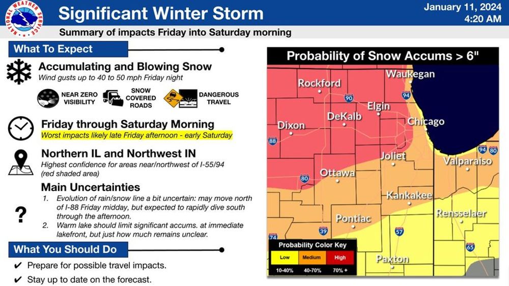
Updates concerning our next storm for Fri-Sat AM. Precip is expected to start in the next 15-17 hrs as snow for much of the metro before the rain/snow line returns for parts of the area. This will effect both rush hr commutes tomorrow. #ilwx#Chicago
While snow begins the day for everyone, rain will mix in especially for areas near the lakefront and along/south of I-80. This may creep north to the I-88/290 corridor before retreating south late Fri as colder air begins to filter into the area. #ilwx#Chicago
Strong winds will lock in causing potential blizzard conditions late Fri and overnight along with a switch back to all snow for most of the area. Travel could be near impossible and not advised in parts of the area during this period. #ilwx#Chicago
Stay tuned for further refinements as we will have the rain/snow line to contend with much like on Tuesday. This'll affect snow accums. No matter what, much colder temps are expected after the storm for early next week as arctic air makes a true push into the US. #ilwx#Chicago