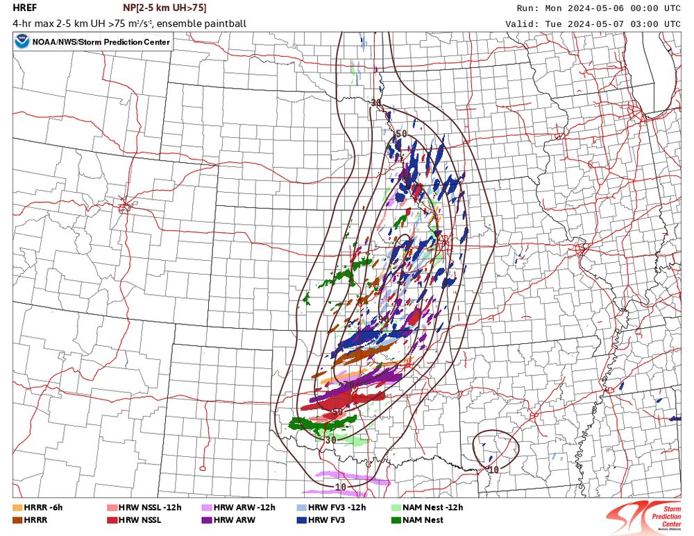
Well, every member of the 00Z HREF producing a giant UH swath somewhere in OK is less than ideal. I have a feeling the highest storm coverage is going to be from roughly Enid-ish northward, but I also bet someone near or south of I-40 gets extremely unlucky tomorrow night.
Failure modes: there are a few, though I'm not sure they're likely.
1) Linear convective mode in KS. This is a failure mode shown by many CAMs this evening, though I'm not sure why. The shear vector orientation to the dryline fits the 45° rule of the thumb over the southern half of the state.
2) No storms in OK. This is contradicted by the 00Z HREF guidance, but if there's a last-minute slowing trend for the upper-level forcing, it's a possibility.
I noticed that too, and it's one of the big reasons I am deciding to sit this one out.
I get the impression that this is a pretty strongly forced event, and at least one RAP sounding I viewed showed a warm nose just below 700 mb, so it could be an issue of the forcing needed.
The contrast in character of the UH tracks in OK cf. KS is stark. While there are some higher magnitudes in KS, the tracks there seem narrower, shorter, and weaker, suggesting a more transient supercell mode compared to in OK, where long track supercells look possible, if not likely.
Assuming model world is resolving what needs to b resolved. Smaller storms are weakest/short lived in the model. But in reality small storms may be long lived with intermittent tors.
My main point was that some models were depicting a difference in character of the UH tracks. I don't actually know what that means for real life. But it's potentially a signal that can help forecasters distinguish threat types across neighboring regions.