Post
[Thread] Some bad map projections I’ve drawn:
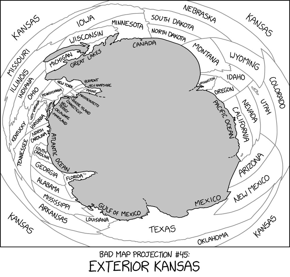
#45: Exterior Kansas xkcd.com/2951
#79: Where each country SHOULD be, according to its time zone(s) xkcd.com/1799
#107: The Liquid Resize xkcd.com/1784
#152: ABS(Longitude) xkcd.com/2807
#248: Madagascator xkcd.com/2613
#299: The Greenland Special xkcd.com/2489
#358: Oops, All South Americas xkcd.com/2256
good evening mr munroe your comic taught me stuff when i was younger but i forgot it all, dang. have a good night
At least Africa looks more like a proper continent.
Apparently photoshop was not aware of Iceland
Maybe Iceland is apolitical?
not once, but twice coloring Crimea in like it's ruzzia is pretty shitty. would like to think better of you. #CrimeaisUkraine .
Clearly everything should be at the same time as the superior time zone, Arizona
Arizona is in a superposition where it's overlaid on top of California for about half the year.
Crimea is Ukraine, you fucking idiot
Greenland looking like it's saying "And then there're THESE assholes"
Title text: "Although Kansas is widely thought to contain the geographic center of the contiguous 48 states, topologists now believe that it's actually their outer edge."
Alt text: https://explainxkcd.com/2951#Transcript
shouldn't there be a bunch of islands in the middle of the central Kansas sea for all the other continents?
Yes my first thought was this is a World = USA map
All of these are still better than Mercator.
Big Farmers trying to keep The Great Corn Wall, and what lies beyond it, hidden from us
This is the only projection I will accept of the CUM zone (Canada, United states, Mexico)
Can’t stop singing “Exterior Kansas” to myself, to the tune of Wilco’s “Impossible Germany”
I have seen the face of Satan.